
Bastia and Cap Corse
Bastia
Between the Old Port and the citadel, the Romieu steps lead up from the quays to the gardens. This town walk makes a natural starting point before exploring the small harbours of Cap Corse.
Corsica: taking time for its shores and villages

A harbour at daybreak, a road climbing inland, then the sea reappearing around a bend: Corsica invites a change of pace as much as a change of scenery. The best starting point is not a race around the island, but a region in which to spend a few days. One town, its neighbouring villages and a stretch of coast are enough to give a journey depth.
Choose one or two bases to alternate heritage, walks and time beside the water. This guide distinguishes the island's main regions and useful precautions, without promising that everything can be covered in a week.
Regions and discoveries
Bastia and Cap Corse
Between the Old Port and the citadel, the Romieu steps lead up from the quays to the gardens. This town walk makes a natural starting point before exploring the small harbours of Cap Corse.

Balagne
From the harbour in Calvi, the citadel stands out above the bay. Walk up from the quays into the upper lanes to see how the town grew around its headland.
Ajaccio and the Gulf of Porto
On Corsica's west coast, this World Heritage property brings together the Calanche of Piana, the Gulf of Girolata and the Scandola reserve. The marker locates the UNESCO property; it is not a hiking trailhead or boarding point.
Bonifacio and the south
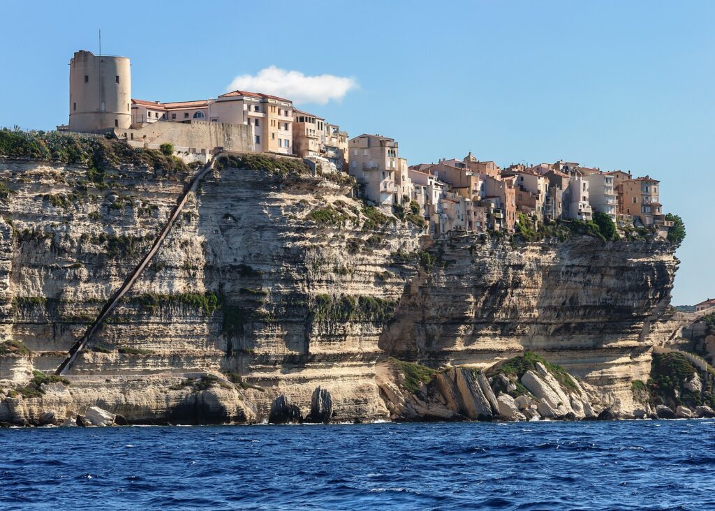
Bonifacio’s harbour lies deep inside an inlet, while the upper town sits on a limestone plateau. The climb from the waterfront makes the contrast particularly clear.
No verified geolocated places in this region.
When to visit this region? →Bastia and Cap Corse
Between the Old Port and the citadel, the Romieu steps lead up from the quays to the gardens. This town walk makes a natural starting point before exploring…
Read and locateBalagne
From the harbour in Calvi, the citadel stands out above the bay. Walk up from the quays into the upper lanes to see how the town grew around…
Read and locateAjaccio and the Gulf of Porto
On Corsica's west coast, this World Heritage property brings together the Calanche of Piana, the Gulf of Girolata and the Scandola reserve. The marker locates the UNESCO property;…
Read and locateBonifacio and the south
Bonifacio’s harbour lies deep inside an inlet, while the upper town sits on a limestone plateau. The climb from the waterfront makes the contrast particularly clear.
Read and locateBastia's old harbour provides an urban introduction before the villages and small coastal settlements of Cap Corse.
Choose an area rather than making repeated return journeys.
Calvi and L'Île-Rousse combine a citadel, harbours and villages close to the coast.
One base allows varied walks without changing accommodation every evening.
Ajaccio offers a historical perspective; further north, Piana and Scandola reveal a coastline shaped by rock and Mediterranean scrub.
Boat trips depend on conditions and conservation rules.
Bonifacio's cliffs and the shores around Porto-Vecchio reveal two sides of southern Corsica.
Alternate a town visit with a less structured day.
Spring and early autumn are useful starting points for combining visits and coastal walks; the mountains require separate preparation.
The coast has a Mediterranean climate, with hot summers and milder winters. Altitude changes conditions significantly: a city or coastal stay requires different preparation from a mountain hike. In the southeast, around Porto-Vecchio, the shoulder seasons offer quieter opportunities to explore inland. These general patterns replace neither a weather forecast nor a check of trail access.
A week can focus on one region; a longer stay allows a second base. This editorial suggestion should be adapted to transport arrangements and your preferred pace.
In winter, favour towns, villages and walks suited to the day's conditions; snow can affect higher ground. In summer, check fire-related access restrictions and keep an alternative to outdoor activities. Outside the main season, confirm accommodation opening dates and transport frequency.
These seasons suit walks, villages and sightseeing without making summer the only reference. Swimming depends on conditions at the time.
Pack an extra layer for evenings.
Mediterranean summers are hot; spreading activities between morning and late afternoon leaves room for breaks.
Check local restrictions and forecasts.
Temperature falls with altitude and conditions cannot be inferred from Ajaccio. Snow and rapid changes require separate preparation.
The coastal series does not certify a mountain itinerary.
Choose a region, then compare the documented local reference points. A point does not describe the whole region.
Local grid reference, not a regional average
Seasonal travel advice is not yet documented for 12 months. The available climate statistics remain accessible below.
Min.Max.
| Month | Mean minimum °C | Mean maximum °C | Rain mm |
|---|---|---|---|
| Jan | 6.1 | 10.5 | 55.3 |
| Feb | 5.8 | 10.8 | 51.7 |
| Mar | 7.6 | 13.4 | 55.0 |
| Apr | 10.0 | 16.2 | 56.8 |
| May | 14.0 | 20.6 | 42.2 |
| Jun | 18.2 | 25.4 | 29.0 |
| Jul | 21.4 | 28.9 | 10.8 |
| Aug | 21.9 | 29.1 | 18.6 |
| Sep | 18.1 | 24.3 | 57.9 |
| Oct | 14.5 | 19.9 | 86.1 |
| Nov | 10.4 | 14.9 | 103.7 |
| Dec | 7.4 | 11.5 | 73.1 |
Local NASA POWER statistical reference from a 0.5° × 0.625° model grid. It does not describe every landform, coastline or microclimate in the area; it is neither a forecast nor a weather guarantee.
NASA POWER · 1991–2020 · 2026-11-17T15:55:19.299020+00:00
MERRA-2: 0.5° latitude × 0.625° longitude
Model-based grid estimates, not local station observations. Precipitation totals are calculated from monthly daily means and calendar days. Sea temperature, sunshine hours and rainy days are not supplied.
Requested reference point: 42.7 / 9.449444
Local grid reference, not a regional average
Seasonal travel advice is not yet documented for 12 months. The available climate statistics remain accessible below.
Min.Max.
| Month | Mean minimum °C | Mean maximum °C | Rain mm |
|---|---|---|---|
| Jan | 6.1 | 9.6 | 50.2 |
| Feb | 5.7 | 9.7 | 47.6 |
| Mar | 7.5 | 12.1 | 51.8 |
| Apr | 9.7 | 14.7 | 54.0 |
| May | 13.4 | 18.8 | 40.4 |
| Jun | 17.3 | 23.1 | 27.7 |
| Jul | 20.3 | 26.2 | 9.1 |
| Aug | 20.9 | 26.7 | 16.2 |
| Sep | 17.5 | 22.6 | 54.0 |
| Oct | 14.2 | 18.7 | 81.0 |
| Nov | 10.3 | 14.0 | 96.9 |
| Dec | 7.3 | 10.7 | 69.2 |
Local NASA POWER statistical reference from a 0.5° × 0.625° model grid. It does not describe every landform, coastline or microclimate in the area; it is neither a forecast nor a weather guarantee.
NASA POWER · 1991–2020 · 2026-11-17T15:55:20.936415+00:00
MERRA-2: 0.5° latitude × 0.625° longitude
Model-based grid estimates, not local station observations. Precipitation totals are calculated from monthly daily means and calendar days. Sea temperature, sunshine hours and rainy days are not supplied.
Requested reference point: 42.567778 / 8.756667
Local grid reference, not a regional average
Seasonal travel advice is not yet documented for 12 months. The available climate statistics remain accessible below.
Min.Max.
| Month | Mean minimum °C | Mean maximum °C | Rain mm |
|---|---|---|---|
| Jan | 6.7 | 10.9 | 81.6 |
| Feb | 6.4 | 11.1 | 71.3 |
| Mar | 8.1 | 13.6 | 70.1 |
| Apr | 10.4 | 16.2 | 64.2 |
| May | 14.2 | 20.4 | 49.6 |
| Jun | 18.1 | 24.7 | 26.6 |
| Jul | 21.1 | 28.0 | 9.2 |
| Aug | 21.9 | 28.6 | 16.1 |
| Sep | 18.5 | 24.3 | 59.6 |
| Oct | 15.1 | 20.3 | 96.2 |
| Nov | 11.0 | 15.3 | 118.6 |
| Dec | 8.0 | 12.1 | 91.8 |
NASA POWER · 1991–2020 · 2026-10-26T13:18:57+00:00
MERRA-2: 0.5° latitude × 0.625° longitude
Model-based grid estimates, not local station observations. Precipitation totals are calculated from monthly daily means and calendar days. Sea temperature, sunshine hours and rainy days are not supplied.
Requested reference point: 41.925555555556 / 8.7363888888889
Local grid reference, not a regional average
Seasonal travel advice is not yet documented for 12 months. The available climate statistics remain accessible below.
Min.Max.
| Month | Mean minimum °C | Mean maximum °C | Rain mm |
|---|---|---|---|
| Jan | 9.7 | 12.1 | 57.2 |
| Feb | 9.3 | 12.1 | 47.5 |
| Mar | 10.6 | 13.8 | 50.1 |
| Apr | 12.4 | 15.9 | 49.3 |
| May | 15.7 | 19.6 | 43.2 |
| Jun | 19.5 | 23.8 | 20.7 |
| Jul | 22.5 | 27.0 | 7.2 |
| Aug | 23.4 | 27.7 | 13.5 |
| Sep | 20.5 | 23.9 | 52.4 |
| Oct | 17.4 | 20.4 | 72.6 |
| Nov | 13.7 | 16.3 | 94.4 |
| Dec | 10.9 | 13.4 | 68.0 |
Local NASA POWER statistical reference from a 0.5° × 0.625° model grid. It does not describe every landform, coastline or microclimate in the area; it is neither a forecast nor a weather guarantee.
NASA POWER · 1991–2020 · 2026-11-17T15:55:22.755153+00:00
MERRA-2: 0.5° latitude × 0.625° longitude
Model-based grid estimates, not local station observations. Precipitation totals are calculated from monthly daily means and calendar days. Sea temperature, sunshine hours and rainy days are not supplied.
Requested reference point: 41.388056 / 9.160556
Discover Scandola from the sea: choose an excursion that respects the reserve's rules and let the geology and scrubland set the pace of observation. Weather can alter or cancel the sailing.
Visit a workshop: find a craftsperson who welcomes visitors, ask about materials and techniques, then take time to see a creation as more than a souvenir. Taste the season: ask for fresh brocciu when production allows, or discover the uses of chestnut flour. A market also offers a chance to understand what genuinely comes from the area. Walk within your abilities: choose a suitable, open route rather than a hike selected for its reputation. In the mountains, uncertain weather is a good reason to change plans.
Choose a base around your arrival point, then alternate a day in town, a walk and a discovery of local produce. Add a second base only if there is enough time to keep some days free of transfers.
An editorial suggestion, not a commercial package; no journey times are guaranteed.
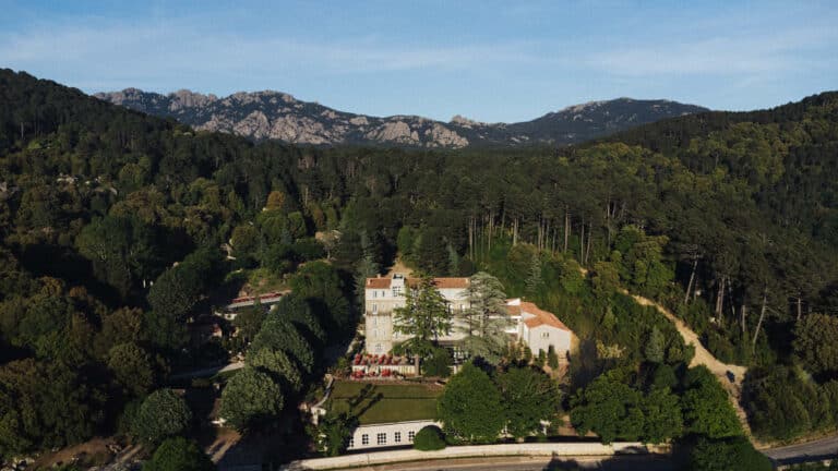
A confidential refuge in Alta Rocca where silence, light, and maquis create an intimate and sensory experience in...
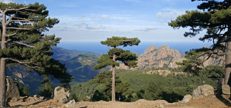
In the mountainous heart of the Alta Rocca, Le Mouflon d'Or welcomes travellers in search of authenticity. This...
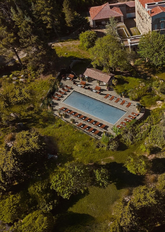
In Zonza, Domaine Le Mouflon d'Or offers a more inward-looking perspective on Corsica: a place where mountains, silence,...
Indicative information to check with the official authorities before departure.
Corsica is part of France. Entry conditions depend on nationality, residence and itinerary; there is no separate island entry regime. When arriving from abroad, use the official France-Visas assistant before booking. Also check the documents required by the carrier, including for children.
Any visa requirements follow the rules for entry into France and the Schengen area. The official France-Visas portal lets you check whether a visa is required for your circumstances; this guide does not replace that check.
Consult the official fire-risk map and closure orders before activities in natural areas. Restrictions can change during the day. In the mountains, choose a suitable route, stay on marked paths and turn back if the weather deteriorates. A coastal walk should not be confused with an alpine hike.
Organise travel around your chosen region. Trains run year-round but do not serve every part of the island; check the Corsican railway network and timetables. For other journeys, verify interurban transport and connections before fixing each stop.
The island can be reached by air or ferry. Airports at Ajaccio, Bastia, Calvi and Figari allow arrival close to the area of your stay. Served ports and sailing frequency vary by company and season: verify the exact route rather than assuming availability from a map.
Confirm the port, departure times, boarding conditions and, where relevant, vehicle specifications when booking. Do not plan a tight connection after a crossing.
Leave time between stops. A day without a long transfer allows a market, village or landscape to be explored rather than reduced to a photograph stop.
In Ajaccio, Maison Bonaparte offers a specific setting in which to approach Napoleon's history. Elsewhere, harbours and citadels invite an understanding of how each town developed. A guided visit or local museum helps connect landscape and history without reducing the whole island to a single individual.
A workshop visit or meeting with a producer brings a different scale to the journey. Pottery, basketry, knife-making and glasswork reveal skills best explored by making an appointment or checking opening days. Favour conversation and time to look rather than simply collecting souvenirs.
Brocciu, made from whey, appears in savoury dishes as well as fiadone. Its fresh form follows the production season: do not expect the same availability year-round. Chestnut flour, canistrelli biscuits, honey and olive oil extend the discovery of local food traditions. At a market, asking about a product's origin and season is more useful than a general promise of authenticity.
Respect private property, places of worship and restrictions in protected areas. Ask before photographing a person or workshop. Take litter away and stay on open routes.
Answers to the most useful questions before you decide.
No. One well-chosen region already allows villages, coast and heritage to be combined. The number of stops should reflect the time available, not a checklist of places.
Yes, by adapting the itinerary and confirming openings and transport connections. Winter suits a quieter exploration; mountain conditions need to be checked separately.
They run year-round but do not cover every area. Check the network, timetables and connections before planning a car-free stay.
No. Weather, ground conditions and fire risk can lead to restrictions. Consult official information and choose an alternative if an area is closed.
Editorial update: October 26, 2026
Practical information last reviewed: 2026-10-24
Ask your question: the answer draws on this guide.
Explore further with Éléonore