

Java and Yogyakarta
Borobudur
Borobudur temple on the island of Java. The marker identifies the monument, not a guaranteed entrance. Coordinates: commons.wikimedia.org ; checked on 24 October 2026.
Choose your islands, leave room for discovery
Javanese heritage, island landscapes and natural environments: build a coherent route rather than trying to connect everything.

Indonesia is best planned island by island. Java, Bali, Sumatra and the territories around Komodo tell different stories and cannot be connected by a simple line on a map. Choosing a reasonable number of stops leaves room for local cultures, visits and transport uncertainties.
Java, Bali, Sumatra and Komodo: reference points for planning an island journey in Indonesia, with updated formalities and precautions.
Javanese heritage, island landscapes and natural environments: build a coherent route rather than trying to connect everything.
Regions and discoveries
Java and Yogyakarta
Borobudur temple on the island of Java. The marker identifies the monument, not a guaranteed entrance. Coordinates: commons.wikimedia.org ; checked on 24 October 2026.
Bali
In Ubud, the palace and central streets make a cultural stop in Bali’s interior. The surrounding rice fields lie outside the town and are not a single visitor site.

Sumatra
In northern Sumatra, Lake Toba fills a vast caldera. Choose a lakeside base or a stop on Samosir Island before arranging transfers: the point on the map marks the lake, not a ferry terminal.
Komodo and its surroundings
Komodo is one of the national park’s islands, distinct from Rinca and Padar. Plan the boat outing around the island to be visited and the park’s rules; wildlife sightings are not guaranteed.
No verified geolocated places in this region.
When to visit this region? →Java and Yogyakarta
Borobudur temple on the island of Java. The marker identifies the monument, not a guaranteed entrance. Coordinates: commons.wikimedia.org ; checked on 24 October 2026.
Read and locateBali
In Ubud, the palace and central streets make a cultural stop in Bali’s interior. The surrounding rice fields lie outside the town and are not a single visitor…
Read and locateSumatra
In northern Sumatra, Lake Toba fills a vast caldera. Choose a lakeside base or a stop on Samosir Island before arranging transfers: the point on the map marks…
Read and locateKomodo and its surroundings
Komodo is one of the national park’s islands, distinct from Rinca and Padar. Plan the boat outing around the island to be visited and the park’s rules; wildlife…
Read and locateTemple heritage and Javanese culture: Yogyakarta provides an urban reference point whose historic axis connects the palace, monuments and rituals.
A cultural landscape associated with the World Heritage-listed subak system; the island should not be reduced to its beaches alone.
World Heritage recognition highlights areas of tropical rainforest. Nature visits must be organised in accordance with local rules and permits.
A UNESCO-recognised national park, to be explored with an authorised operator and according to sailing conditions.
In Yogyakarta, the city's layout connects the palace, monuments, rituals and landscape within a Javanese view of the world. Elsewhere, temple ensembles, cultural landscapes and national parks offer other ways into the destination. This guide distinguishes these reference points without promising access to a volcano, a wildlife encounter or a crossing: each activity depends on conditions and rules that must be checked.
For travellers interested in heritage, living cultures and nature, willing to limit their stops to explore them more fully.
Allow time between flights, boats and activities; avoid tight connections.
For a first Java–Bali itinerary, the generally drier season runs from April to October. Adapt the calendar for other islands.
Indonesia's tropical climate is best understood through rainfall and altitude. Java and Bali generally have a drier season from April to October, followed by a wetter season from November to March. These reference points are neither a forecast nor a universal calendar for every island: transitions vary, and higher ground requires separate preparation.
Plan alternatives and consult alerts before hikes, crossings and rural journeys. Volcanic restrictions do not depend solely on the season.
April to October: generally drier season. November to March: generally wetter season. Allow for showers and check local conditions before travelling.
Indonesian Ministry of Tourism, Seasons, climate and weather, accessed October 24, 2026.
At the Lake Toba reference, NASA POWER 1991–2020 averages show rainfall throughout the year, higher from August to December than in June. Do not apply Bali's dry season here: allow breaks and alternative activities.
This local reference does not describe the whole of Sumatra.
At the Komodo reference, 1991–2020 averages show much less rainfall from June to September than from December to March. This difference helps with planning visits, but is not enough to decide whether to make a sea crossing.
Check sea conditions and local advice; Komodo does not represent every neighbouring island.
Choose a region, then compare the documented local reference points. A point does not describe the whole region.
Local grid reference, not a regional average
Seasonal travel advice is not yet documented for 12 months. The available climate statistics remain accessible below.
Min.Max.
| Month | Mean minimum °C | Mean maximum °C | Rain mm |
|---|---|---|---|
| Jan | 20.8 | 26.2 | 329.9 |
| Feb | 20.9 | 26.0 | 314.7 |
| Mar | 21.1 | 26.5 | 234.4 |
| Apr | 21.1 | 26.8 | 194.1 |
| May | 20.4 | 26.8 | 155.3 |
| Jun | 19.5 | 26.2 | 105.3 |
| Jul | 18.4 | 26.2 | 61.1 |
| Aug | 18.1 | 27.2 | 38.9 |
| Sep | 19.0 | 28.9 | 71.0 |
| Oct | 20.2 | 29.2 | 164.6 |
| Nov | 21.0 | 27.8 | 257.4 |
| Dec | 20.9 | 26.7 | 296.6 |
NASA POWER · 1991–2020 · 2026-10-26T13:22:46+00:00
MERRA-2: 0.5° latitude × 0.625° longitude
Model-based grid estimates, not local station observations. Precipitation totals are calculated from monthly daily means and calendar days. Sea temperature, sunshine hours and rainy days are not supplied.
Requested reference point: -7.607889 / 110.203789
Local grid reference, not a regional average
Seasonal travel advice is not yet documented for 12 months. The available climate statistics remain accessible below.
Min.Max.
| Month | Mean minimum °C | Mean maximum °C | Rain mm |
|---|---|---|---|
| Jan | 23.8 | 28.0 | 310.0 |
| Feb | 23.9 | 27.7 | 250.4 |
| Mar | 23.9 | 28.1 | 189.7 |
| Apr | 23.9 | 28.2 | 130.8 |
| May | 23.3 | 27.8 | 74.4 |
| Jun | 22.5 | 27.0 | 47.1 |
| Jul | 21.7 | 26.5 | 33.8 |
| Aug | 21.3 | 27.0 | 22.3 |
| Sep | 21.9 | 28.3 | 34.1 |
| Oct | 23.0 | 29.6 | 71.5 |
| Nov | 23.9 | 29.7 | 140.5 |
| Dec | 23.9 | 28.7 | 252.5 |
Local NASA POWER statistical reference from a 0.5° × 0.625° model grid. It does not describe every landform, coastline or microclimate in the area; it is neither a forecast nor a weather guarantee.
NASA POWER · 1991–2020 · 2026-11-17T15:30:55.365583+00:00
MERRA-2: 0.5° latitude × 0.625° longitude
Model-based grid estimates, not local station observations. Precipitation totals are calculated from monthly daily means and calendar days. Sea temperature, sunshine hours and rainy days are not supplied.
Requested reference point: -8.507 / 115.262
Local grid reference, not a regional average
Seasonal travel advice is not yet documented for 12 months. The available climate statistics remain accessible below.
Min.Max.
| Month | Mean minimum °C | Mean maximum °C | Rain mm |
|---|---|---|---|
| Jan | 17.3 | 23.5 | 225.6 |
| Feb | 17.4 | 24.1 | 198.7 |
| Mar | 17.8 | 24.3 | 268.9 |
| Apr | 18.3 | 24.4 | 261.4 |
| May | 18.2 | 24.1 | 252.5 |
| Jun | 17.5 | 23.3 | 186.8 |
| Jul | 17.1 | 23.1 | 246.0 |
| Aug | 17.2 | 23.2 | 306.9 |
| Sep | 17.3 | 23.4 | 327.8 |
| Oct | 17.4 | 23.5 | 395.6 |
| Nov | 17.6 | 23.3 | 413.0 |
| Dec | 17.4 | 23.1 | 341.0 |
Local NASA POWER statistical reference from a 0.5° × 0.625° model grid. It does not describe every landform, coastline or microclimate in the area; it is neither a forecast nor a weather guarantee.
NASA POWER · 1991–2020 · 2026-11-17T15:30:57.101346+00:00
MERRA-2: 0.5° latitude × 0.625° longitude
Model-based grid estimates, not local station observations. Precipitation totals are calculated from monthly daily means and calendar days. Sea temperature, sunshine hours and rainy days are not supplied.
Requested reference point: 2.67 / 98.8875
Local grid reference, not a regional average
Seasonal travel advice is not yet documented for 12 months. The available climate statistics remain accessible below.
Min.Max.
| Month | Mean minimum °C | Mean maximum °C | Rain mm |
|---|---|---|---|
| Jan | 27.1 | 28.4 | 249.6 |
| Feb | 27.0 | 28.2 | 225.1 |
| Mar | 27.3 | 28.5 | 198.9 |
| Apr | 27.5 | 28.9 | 142.1 |
| May | 27.0 | 28.9 | 66.1 |
| Jun | 26.2 | 28.4 | 28.2 |
| Jul | 25.6 | 28.1 | 20.2 |
| Aug | 25.5 | 28.3 | 12.2 |
| Sep | 26.2 | 29.2 | 31.7 |
| Oct | 27.3 | 30.0 | 60.2 |
| Nov | 28.0 | 29.9 | 147.8 |
| Dec | 27.6 | 28.9 | 245.3 |
Local NASA POWER statistical reference from a 0.5° × 0.625° model grid. It does not describe every landform, coastline or microclimate in the area; it is neither a forecast nor a weather guarantee.
NASA POWER · 1991–2020 · 2026-11-17T15:30:58.526194+00:00
MERRA-2: 0.5° latitude × 0.625° longitude
Model-based grid estimates, not local station observations. Precipitation totals are calculated from monthly daily means and calendar days. Sea temperature, sunshine hours and rainy days are not supplied.
Requested reference point: -8.576942 / 119.451111
Discover the monuments and cultural meaning of Yogyakarta's axis. Explore temple ensembles after checking access conditions. Understand Bali's subak cultural landscape without entering private or sacred spaces without permission. Choose a guided nature experience rather than an improvised wildlife encounter.
Devote the first part of the journey to Java's heritage, then choose a single extension according to the time available. Allow extra time for transfers; this suggestion is neither a package nor a guaranteed connection.

The Grand Mirage Resort Bali: an all-inclusive hotel in Nusa Dua, offering relaxation, thalassotherapy, family activities, and luxurious...

An eco-luxury sanctuary perched on Nusa Penida, where silence, nature and refinement redefine tropical escape. Welcome to MĀUA.
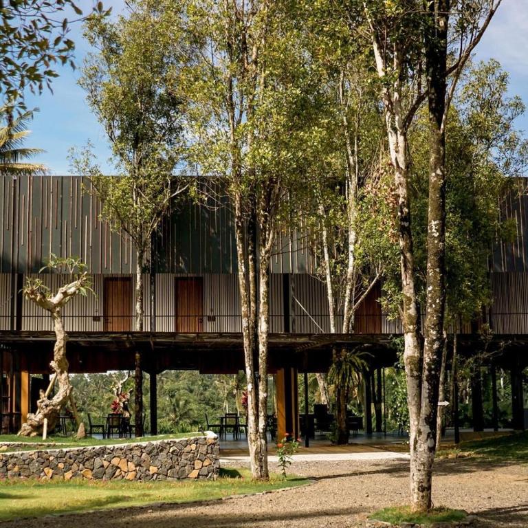
In Licin, in the Banyuwangi countryside, Teras Hotel Ijen plays the discreet yet essential role of a breathing...
Indicative information to check with the official authorities before departure.
French nationals can obtain a paid 30-day visa on arrival for certain short visits, including tourism; this is not a visa exemption. Carry proof of onward departure. Complete the official All Indonesia form within 72 hours before arrival and retain the QR code.
A passport in good condition, valid for more than six months on entry, with sufficient blank pages. A damaged document can result in refusal of entry.
The visa on arrival is single-entry and can be extended once for 30 days through immigration. For a different purpose, obtain the appropriate visa before departure. Check official entry points and procedures.
Prepare the trip with a doctor or travel-health centre: vaccination and prevention requirements depend on the islands, duration and activities. Dengue and other mosquito-borne diseases require appropriate protection; malaria risk varies by region and rural area. Carry prescriptions and check whether medicines may be imported, particularly psychotropic drugs. Fever during travel or after returning requires prompt medical advice, including details of your itinerary.
Earthquakes, tsunamis, active volcanoes, flooding and landslides are risks to prepare for. Check alerts and exclusion zones before activities, and follow local instructions.
Hikes must be accompanied by accredited guides, particularly in the mountains and around volcanoes. A specific tourist levy applies in Bali; check its amount, exemptions and the official Love Bali channel before travelling.
Ask specifically about steps, trails, jetties, vehicles and accommodation access; accessibility varies greatly between islands and sites.
Inter-island journeys require checks of timetables, conditions and connection margins. Night driving is discouraged; two-wheeled vehicles carry a high risk.
The Indonesian rupiah is used for local spending. Cards are common in major hotels, restaurants and shops but are not universally accepted. Carry small notes and arrange withdrawals before remote stops; check charges and limits with your bank. No fixed exchange rate is guaranteed here.
Prepare national formalities, island-specific requirements and activity conditions separately. Do not confuse the All Indonesia form with a visa.
Yogyakarta's historic axis was established in the 18th century around the sultan's palace. It reflects exchanges between several belief systems and cultural traditions. Borobudur and Prambanan are other major reference points in Indonesian heritage.
Yogyakarta's Javanese traditions connect the organisation of space with life cycles, ceremonies and relationships with nature. This living heritage calls for observation of customs and respect for places of practice rather than treating them as scenery.
The journey continues at the table: nasi goreng, fried rice with varied accompaniments, differs from a soto served as broth or a slowly spiced rendang associated with the Minangkabau traditions of western Sumatra. In Bali, sate lilit combines a finely worked mixture with coconut; elsewhere, skewers and sauces change from region to region. Gado-gado brings together vegetables, tofu or tempeh and peanut sauce. Ask about exact ingredients if you have allergies or dietary requirements, without assuming a vegetable dish is vegan.
National unity does not erase island traditions. Java and Sundanese communities, predominantly Hindu Bali, and the territories of Toraja and northern Sumatra reveal different cultural perspectives. Customs observed on one island should not be treated as a common rule throughout the archipelago.
Answers to the most useful questions before you decide.
No. The form combines arrival declarations; a visa remains a separate requirement depending on nationality and purpose of stay.
No. Check exclusion zones, use an accredited guide and respect the authorities' decisions.
A limited number of stops allows more time for visits and reduces connection-related risks.
Editorial update: October 26, 2026
Practical information last reviewed: 2026-10-24
Ask your question: the answer draws on this guide.
Explore further with Éléonore