
Santo Domingo
From the heritage of Santo Domingo to Caribbean horizons
Choose your stops between city, coast and nature, with practical guidance that leaves room for the journey.
Some sections are not yet available in this language.
The Dominican Republic is more than a beach. Santo Domingo opens an urban and historical chapter, while coastal destinations invite different rhythms. Punta Cana, Samaná, Puerto Plata and Bayahibe are not interchangeable: choose your stops around what you want to explore and the transfers actually involved.
Santo Domingo, coastlines and Dominican destinations: a documented starting point for choosing your stops and preparing entry formalities.
Choose your stops between city, coast and nature, with practical guidance that leaves room for the journey.
Regions and discoveries
Santo Domingo
Punta Cana, Bayahibe and La Romana
In Bayahibe, excursion boats lie alongside the village on the Caribbean shore. A waterfront walk is a different experience from a boat trip to Saona Island.
Samaná and Las Terrenas
On the north coast of the Samaná Peninsula, Las Terrenas stretches along the shore. The town is a base for nearby beaches, distinct from excursions into Samaná Bay.
Puerto Plata and the interior
In Puerto Plata, walk from the historic centre to the Malecón. Fort San Felipe offers another perspective from the waterfront on this north-coast city.
No verified geolocated places in this region.
When to visit this region? →Punta Cana, Bayahibe and La Romana
In Bayahibe, excursion boats lie alongside the village on the Caribbean shore. A waterfront walk is a different experience from a boat trip to Saona Island.
Read and locateSamaná and Las Terrenas
On the north coast of the Samaná Peninsula, Las Terrenas stretches along the shore. The town is a base for nearby beaches, distinct from excursions into Samaná Bay.
Read and locatePuerto Plata and the interior
In Puerto Plata, walk from the historic centre to the Malecón. Fort San Felipe offers another perspective from the waterfront on this north-coast city.
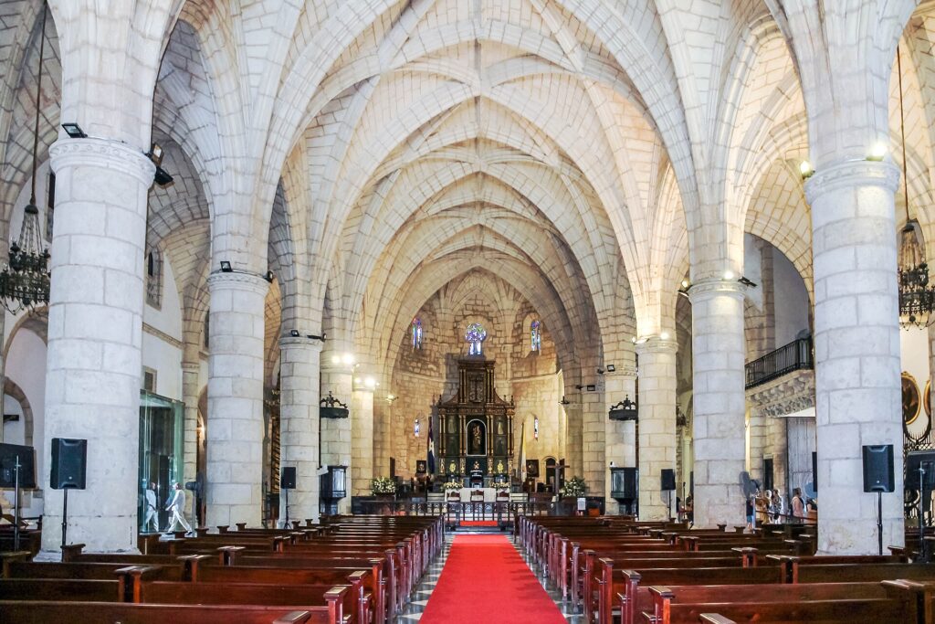
Read and locateThe Colonial City, beside the Ozama River, is a major heritage stop. Allow time to explore and understand its history.
Distinct places to stay, chosen according to your interests, accommodation and available transfers; do not treat them as a single resort.
Two destinations on the national tourism map around which to plan another stage of the journey, after checking transport links.
The tourism board also features Puerto Plata, Jarabacoa and La Vega among the country’s destinations: a stay can extend beyond the beach resorts of the south-east.
A walk through the Colonial City, a day by the sea, a guided nature activity: a journey benefits from changing surroundings without accumulating kilometres. The capital also recalls the complex history of colonisation and cultural encounters. Taking time to understand places, rather than simply photograph them, brings another dimension to a stay.
Travellers who want to combine heritage, the sea and exploration with a beach stay.
Choose a limited number of bases and favour daytime transfers.
December to early March generally offers more comfortable conditions for a first stay; distinguish coastal areas, the North and the mountains.
Plan the timing of your trip around the region you choose. The NASA POWER 1991–2020 series shown here describes a grid point near Santo Domingo and the southern coast, where average rainfall is lower from January to March. It cannot rank months for Samaná, the northern coast or the mountains. From June to November, hurricane season calls for monitoring alerts and adapting travel plans; it does not mean constant storms.
During a tropical storm, take shelter and follow official instructions. Do not cross a flooded road to keep an excursion on schedule.
The documented series shows lower average rainfall from January to March. It does not describe every coast.
Climate normals are not a forecast for your stay.
Do not automatically apply the southern coast's calendar to Atlantic stops. Check forecasts and sea conditions before outings.
The Las Terrenas and Puerto Plata references complement the southern one; they do not describe every bay or the mountains.
In Jarabacoa or Constanza, mornings and nights can be much cooler than on the coast.
Pack an extra layer.
Humidity is more pronounced from April to October. From June to November, also follow official hurricane alerts.
Keep plans flexible.
Choose a region, then compare the documented local reference points. A point does not describe the whole region.
Local grid reference, not a regional average
Seasonal travel advice is not yet documented for 12 months. The available climate statistics remain accessible below.
Min.Max.
| Month | Mean minimum °C | Mean maximum °C | Rain mm |
|---|---|---|---|
| Jan | 21.3 | 29.3 | 24.6 |
| Feb | 21.3 | 29.8 | 20.9 |
| Mar | 21.6 | 30.4 | 21.5 |
| Apr | 22.7 | 31.1 | 33.8 |
| May | 23.8 | 30.9 | 58.7 |
| Jun | 24.5 | 31.1 | 41.0 |
| Jul | 24.7 | 31.5 | 50.1 |
| Aug | 24.9 | 31.6 | 61.1 |
| Sep | 24.8 | 31.4 | 57.7 |
| Oct | 24.4 | 30.9 | 57.8 |
| Nov | 23.3 | 30.2 | 60.7 |
| Dec | 22.1 | 29.5 | 37.7 |
A reference for Santo Domingo and the southern coast, based on a climate grid rather than a local weather station. This series does not represent the central mountains, the entire north coast or Samaná. Average rainfall is lower from January to March at this point; the figures do not predict conditions during a stay. The June-to-November hurricane season requires monitoring official alerts regardless of monthly averages.
NASA POWER · 1991–2020 · 2026-10-24T18:16:22+00:00
MERRA-2: 0.5° latitude × 0.625° longitude
Model-based grid estimates, not local station observations. Precipitation totals are calculated from monthly daily means and calendar days. Sea temperature, sunshine hours and rainy days are not supplied.
Requested reference point: 18.4625 / -69.9361111111
Local grid reference, not a regional average
Seasonal travel advice is not yet documented for 12 months. The available climate statistics remain accessible below.
Min.Max.
| Month | Mean minimum °C | Mean maximum °C | Rain mm |
|---|---|---|---|
| Jan | 22.6 | 29.3 | 39.7 |
| Feb | 22.5 | 29.9 | 25.0 |
| Mar | 23.0 | 30.7 | 27.2 |
| Apr | 24.0 | 31.5 | 42.8 |
| May | 24.9 | 31.4 | 61.6 |
| Jun | 25.5 | 31.4 | 43.9 |
| Jul | 25.8 | 31.7 | 50.5 |
| Aug | 26.1 | 31.9 | 57.0 |
| Sep | 25.9 | 31.7 | 68.9 |
| Oct | 25.3 | 31.2 | 59.9 |
| Nov | 24.4 | 30.3 | 80.6 |
| Dec | 23.3 | 29.6 | 42.6 |
Local NASA POWER statistical reference from a 0.5° × 0.625° model grid. It does not describe every landform, coastline or microclimate in the area; it is neither a forecast nor a weather guarantee.
NASA POWER · 1991–2020 · 2026-11-17T15:33:48.724655+00:00
MERRA-2: 0.5° latitude × 0.625° longitude
Model-based grid estimates, not local station observations. Precipitation totals are calculated from monthly daily means and calendar days. Sea temperature, sunshine hours and rainy days are not supplied.
Requested reference point: 18.366667 / -68.833333
Local grid reference, not a regional average
Seasonal travel advice is not yet documented for 12 months. The available climate statistics remain accessible below.
Min.Max.
| Month | Mean minimum °C | Mean maximum °C | Rain mm |
|---|---|---|---|
| Jan | 24.9 | 26.0 | 61.2 |
| Feb | 24.6 | 25.8 | 37.1 |
| Mar | 24.6 | 25.9 | 43.2 |
| Apr | 25.1 | 26.4 | 59.0 |
| May | 26.0 | 27.2 | 99.6 |
| Jun | 27.0 | 28.1 | 63.0 |
| Jul | 27.4 | 28.4 | 87.6 |
| Aug | 27.7 | 28.7 | 98.8 |
| Sep | 27.7 | 28.9 | 105.6 |
| Oct | 27.4 | 28.6 | 95.4 |
| Nov | 26.7 | 27.7 | 113.5 |
| Dec | 25.8 | 26.8 | 64.3 |
Local NASA POWER statistical reference from a 0.5° × 0.625° model grid. It does not describe every landform, coastline or microclimate in the area; it is neither a forecast nor a weather guarantee.
NASA POWER · 1991–2020 · 2026-11-17T15:33:50.573712+00:00
MERRA-2: 0.5° latitude × 0.625° longitude
Model-based grid estimates, not local station observations. Precipitation totals are calculated from monthly daily means and calendar days. Sea temperature, sunshine hours and rainy days are not supplied.
Requested reference point: 19.32 / -69.53
Local grid reference, not a regional average
Seasonal travel advice is not yet documented for 12 months. The available climate statistics remain accessible below.
Min.Max.
| Month | Mean minimum °C | Mean maximum °C | Rain mm |
|---|---|---|---|
| Jan | 23.4 | 26.6 | 50.0 |
| Feb | 23.1 | 26.6 | 30.7 |
| Mar | 23.2 | 26.9 | 40.7 |
| Apr | 23.8 | 27.6 | 42.9 |
| May | 24.8 | 28.2 | 77.3 |
| Jun | 25.9 | 29.2 | 48.3 |
| Jul | 26.3 | 29.3 | 53.4 |
| Aug | 26.5 | 29.7 | 65.1 |
| Sep | 26.6 | 29.8 | 77.3 |
| Oct | 26.2 | 29.4 | 76.1 |
| Nov | 25.3 | 28.1 | 94.0 |
| Dec | 24.3 | 27.2 | 51.2 |
Local NASA POWER statistical reference from a 0.5° × 0.625° model grid. It does not describe every landform, coastline or microclimate in the area; it is neither a forecast nor a weather guarantee.
NASA POWER · 1991–2020 · 2026-11-17T15:33:52.012969+00:00
MERRA-2: 0.5° latitude × 0.625° longitude
Model-based grid estimates, not local station observations. Precipitation totals are calculated from monthly daily means and calendar days. Sea temperature, sunshine hours and rainy days are not supplied.
Requested reference point: 19.795833 / -70.694444
Walk through Santo Domingo’s Colonial City to explore its street plan and heritage. Alternate a cultural stop with time by the sea rather than multiplying transfers. Choose a nature activity with verified guidance, conditions and access.
Allow two or three nights in Santo Domingo to explore the colonial city beside the Ozama. Continue to one beach base: Bayahibe or Punta Cana, depending on your accommodation and airport. Leave a flexible day for each change of base.
Editorial suggestion; transport and excursions are not included. Check transfers before booking.
Choose one base on the peninsula and alternate days by the sea with nearby discoveries. A few carefully chosen outings are preferable to crossing the country every day. Choose your airport and transfer around the exact location of your accommodation.
No boat trip or wildlife sighting is guaranteed by this itinerary.
Indicative information to check with the official authorities before departure.
French nationals may visit as tourists for up to 30 days. Complete the free official e-Ticket form for entry and departure and keep the QR code. Check passport and airline requirements before travelling.
The general rule requires a passport valid for at least six months. An exceptional measure in force until 31 December 2026 allows, among others, European Union nationals travelling as tourists to use a passport valid throughout their stay and until departure. Recheck this exception with the authorities and your carrier before travelling, particularly for a trip in 2027. The e-Ticket does not replace a passport.
To remain beyond the 30-day tourist period, request an extension from immigration before it expires. Paying a possible departure fee does not make an overstay lawful.
Arrange insurance covering medical care, hospitalisation and repatriation, then consult a doctor or travel-health clinic before departure. Protection against mosquito bites and food and water hygiene are important. Vaccination recommendations and precautions vary with your itinerary, the health situation and transit countries; check current official guidance rather than treating this mini-guide as medical advice.
Stay alert to theft and assault, avoid travelling at night and follow local advice. During a tropical storm, postpone journeys: roads can flood quickly.
Hurricane season runs from June to November. Monitor alerts during your stay, check cancellation conditions and allow flexibility for transport.
Ask specifically about access to rooms, vehicles and activities. Historic sites, a beach and a nature excursion present different constraints.
Plan daytime transfers and allow extra time between stops. Road users can behave unpredictably; a road in good condition does not mean a risk-free journey.
Use only the free official e-Ticket portal. For an address in Santo Domingo, choosing Santo Domingo de Guzman allows you to find the capital’s neighbourhoods.
Founded in the late 15th century, Santo Domingo’s Colonial City played a central role in European expansion in the Americas. Its grid plan and monuments bear witness to that period. A visit benefits from also considering Indigenous peoples and African history, rather than reducing the past to picturesque scenery.
The journey continues through merengue and bachata, two major expressions of Dominican musical life. The traditional merengue associated with Cibao and bachata, shaped by popular encounters and subsequent urban development, tell different stories. A live-music venue or workshop with a local practitioner can reveal more than a standard holiday performance, depending on what is actually available.
Dominican cooking brings together Taíno, African and Spanish influences. Rice and beans often accompany meat; in moro, they are cooked together. Plantain appears as mangú, a mash, or as tostones, fried slices. Sancocho combines meat and starchy vegetables in a generous stew, while cassava is used to make casabe. Along the coast, coconut milk adds another note to some dishes. Tasting a few specialities as you travel reveals a cuisine more varied than the hotel buffet alone.
Answers to the most useful questions before you decide.
Yes. The official form generates a QR code required for entering and leaving the country. Avoid paid intermediaries.
Up to 30 days according to France Diplomatie. An extension must be requested before that period expires.
It requires greater vigilance from June to November, monitoring alerts and being prepared to adapt your plans.
Editorial update: October 26, 2026
Practical information last reviewed: 2026-10-24
Ask your question: the answer draws on this guide.
Explore further with Éléonore